Megalithic structures
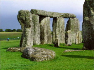 The idea of the existence of a relationship between the various monumental buildings, located in different continents hovers in the minds of various researchers for a long time. It is very much common in these constructions.
For the first time the hypothesis that the ancient megalithic structures may be located on our planet on a particular system, launched in 70 years, Russian scientists N. F.Goncharov, V. A. Makarov and V. S. Morozov. According to their theory, the Earth’s core is a growing crystal of iron, which induces in all the shells of the planet two correct symmetry of Platonic polyhedra – the icosahedron and the dodecahedron, and the hierarchy of subsystems the main division. The vertices of this crystal, and there are foci of most ancient civilizations, pyramids and other famous structures.
Then the famous Bashkir doctor and researcher of ancient civilizations Ernst MULDASHEV proposed his system of pyramids, in which he linked the location of Giza, Easter island, mount Kailash and several other famous places. Unfortunately, the system was crude and could not stand the geographical review. But as it usually happens, thanks to E. Muldasheva the idea became stronger and gained many supporters. Hundreds of researchers began their own research in this direction,and I must say have made very significant progress. The most interesting material on this topic is available on our website in the section “ISTORICHESKIE GEODESY”.
Thus, article LINE JIM ALLISON described lines are great circles – the great-circle distance connecting some famous historical sites. One of them, the line of the Great pyramid (VP) – O. Easter, runs through the famous drawings in the Nazca desert, and many other sacred places. And Nazca lies in the Golden section of the line between EAP and its antithesis. Also this line, which can be considered a major, has a number of amazing properties and patterns.
If to continue research in this direction, and connect the most significant buildings of antiquity between the lines, and spend their latitude and meridians, you get a global network of lines covering the entire planet. In the process of studying the network revealed distinct patterns for the first time allow us to speak about existence of a certain system in the arrangement of the pyramids, temples and other megalithic structures.
All lines – the great-circle distance between the objects on the form globe, at first glance, a chaotic grid of intersecting lines. But a closer study reveals many patterns, random occurrence which is extremely unlikely.
In this publication, devoted to lines of large circles shown some regularities in the location of historic sites, which is actually much more. Their careful study, classification and search of principles for a system in the nearest future. But so far, the theory of paleocontact and the existence of the ancient highly developed planetary civilization for the first time provide real evidence with the most incredible parties.
It seems that known prehistoric sites are part of the ancient geodetic or navigation system, in which pyramids and temples, along with other functions, play the role of landmarks and reference points clearly visible even from space.
On the interactive map at the end of the article you can see most of these patterns. The most correct map is displayed in the browser Mazila Firefox. To view an interactive map you must install the Google Earth plugin.
